Hi, A few years ago someone asked, ‘Is your work life stressful’? I was extremely stressed! Never enough time for myself/family. I was completely overloaded, overwhelmed & had no work life balance. I realised the most important thing I needed was time. So, after 20 years I am taking some time out. My intention is to create high quality resources, to help teachers take control of their workload, help reduce stress & enable their children to Love Learning Geography.
Hi, A few years ago someone asked, ‘Is your work life stressful’? I was extremely stressed! Never enough time for myself/family. I was completely overloaded, overwhelmed & had no work life balance. I realised the most important thing I needed was time. So, after 20 years I am taking some time out. My intention is to create high quality resources, to help teachers take control of their workload, help reduce stress & enable their children to Love Learning Geography.
**Primary Geography Key Stage one SOW National Curriculum full scheme of work **
I have included everything you need to cover the key stage 1 Geography National Curriculum. It has taken me over 90 hours to create everything. My aim is to improve the transition for primary to secondary geography. Suitable for a nonspecialist.
The work is divided into 12 sections. There are interactive, vibrant power points, maps, worksheets, starters, recaps/plenaries, lesson plans, IT activities word maps & fieldwork opportunities. Each power point can be adapted to meet the needs of your learners.
To help SEN students I have included a variety of learning styles. All font is in Comic sans, to support dyslexic learners. The scheme of work can be easily adapted to meet the needs of higher level learners.
There are two differentiated assessments. An interim assessment at the end of section 5 and after section 12. A student revision exam poster. Print out the beautiful colourful word mats. They look great in colour, double sided and laminated. Also includes IT activities and fieldwork opportunities.
Includes the following topics:
• Locate the seven continents
• Locate the five oceans
• Use atlases, globes and maps
• Use compass directions
• Locate hot and cold areas across the world
• Study of the UK – including location and characteristics
• Countries in the UK, capital cities and water areas
• Key stage 1 interim exam
• Weather in the UK- including weather patterns
• Seasons in the UK
• Introduction of physical geography
• Introduction of human geography
• Look at National Parks in the UK and Kenya
• Comparing similarities and differences of human and physical geography
• Looking at similar and differences
• Drawing a simple sketch map
• Fieldwork activities- aerial photographs, sketching, types of geography & bar graphs
• IT activities
Students will have everything they need to start key stage 2 geography. I will be uploading key stage 2 in a couple of months time (when I have finished making it). I hope your students love learning geography :)
** water cycle flows waterfalls meanders V-shaped valleys gorges rapids Ox-bow lakes floodplains etc ks3 ks4**
A collection of resources to help students understand background information on rivers, water cycle, flows, inputs, stores, processes and landform formation (paper 1). Easy to follow if non-specialist. Specific to the OCR ks4 spec.
Interactive power points, work sheet and exam questions. This resource will help your students learn the formation of river landforms. Information covered:
brief recap- water cycle, inputs, flows, stores, underground etc
*What influences the amount of water in a drainage basin?
formation of waterfalls, gorges & rapids
Meanders & Ox-bow lakes
V-shaped valleys & interlocking spurs
Floodplain and Levees
Suitable for ks3 ks4. The resources can be used on its OWN or with the other resources. The power points are vibrant and interactive. The power point can be used on a white board or with a projector. They have animations and moving objects. The power points are easy to use and explain. Sources are on the power point.
REMOVE THE WATERMARK AND THE FILES ARE THE SAME AS THE COVER PICTURE
If you are looking for vibrant, interesting and fun activities…….take a look at my other resources. I have created power points on OCR background to rivers, geomorphological processes, river landforms and the river case study.
I will be adding lots of new resources. Follow me and thank you if you have time to give me feedback.
Hope your class loves learning with my resources :)
** Formation of waterfalls, gorges, meanders, levees, floodplains etc ks3 ks4**
A collection of resources to help students understand geomorphic processes (paper 1). Easy to follow if non-specialist. Specific to the OCR ks4 spec. An interactive power point and exam questions. This resource will help your students learn the formation of river landforms. Information covered:
waterfalls, gorges & rapids
Meanders & Ox-bow lakes
V-shaped valleys & interlocking spurs
Floodplain and Levees
Suitable for ks3 ks4. The resources can be used on its OWN or with the other resources. The power point is vibrant and interactive. The power point can be used on a white board or with a projector. They have animations and moving objects. The power points are easy to use and explain. Sources on the power point.
REMOVE THE WATERMARK AND THE FILES ARE THE SAME AS THE COVER PICTURE
If you are looking for vibrant, interesting and fun activities…….take a look at my other resources. I have created power points on background to rivers, geomorphological processes and the river case study.
I will be adding lots of new resources. Follow me and thank you if you have time to give me feedback.
Hope your class loves learning with my resources :)
**OCR flooding ks3 ks4 River management techniques flood defences dealing with flooding **
A collection of resources to help students understand river management information (paper 1). Easy to follow if non-specialist. Specific to the OCR ks4 spec.
Contains an interactive power point, a quiz and worksheet. This resource will help your students learn the different types of soft and hard defences. Suitable for ks3 ks4. The resources can be used on its OWN or with the other resources. The power point is vibrant and interactive. The power point can be used on a white board or with a projector. They have animations and moving objects. The power points are easy to use and explain. Sources are on the power point.
REMOVE THE WATERMARK AND THE FILES ARE THE SAME AS THE COVER PICTURE
If you are looking for vibrant, interesting and fun activities…….take a look at my other resources. I have created power points on OCR background to rivers, geomorphological processes, river landforms, river management and the river case study.
I will be adding lots of new resources. Follow me and thank you if you have time to give me feedback.
Hope your class loves learning with my resources :)
**Literacy geography ks1 ks2 continents UK world oceans skills countries vibrant 2 resources **
This pdf resource looks great in colour, double sided and laminated.
REMOVE THE WATERMARK AND THE FILES ARE THE SAME AS THE COVER PICTURE
Hope your students love learning with my resource :)
Primary Geography Key Stage One & Two bundle
Full KS1 Geography National Curriculum
Full KS2 Physical Geography National Curriculum
KS1- The work is divided into 12 sections
KS2- The work is divided into 16 sections.
Details on each bundle.
There are animated & interactive vibrant power points, maps, worksheets, starters, recaps/plenaries, basic lesson plan, IT activities & fieldwork opportunities. Each power point can be adapted to meet the needs of your learners.
This will save you so much time. It is easy to follow and will help students build their confidence in geography. You can teach the sections at your own pace and the ppts can be easily tweaked to your class. The two SOW have taken me over 210 hours to create everything. My aim is to improve the transition from primary to secondary geography. Suitable for a non-specialist.
To help SEN students I have included a variety of learning styles. All font is in Comic sans, to support dyslexic learners. The scheme of work can be easily adapted to meet the needs of higher-level learners.
There are two differentiated assessments. An interim assessments. A student revision exam poster. Also includes IT activities and fieldwork opportunities.
I hope your students love learning geography :)
T&C By purchasing my resources, you are agreeing that the contents are the property of Love Learning Geography and licensed to you only for classroom/personal use as a single user. I retain copyright and reserve all rights to this product. You are not permitted to resell or share this item. You may not share it anywhere online (except on secure platforms with your own students).
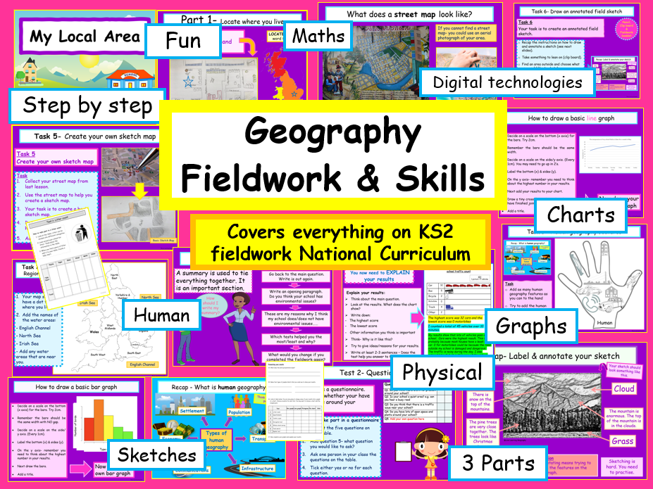
Primary Geography Key Stage One, Two & Fieldwork bundle
Full KS1 Geography National Curriculum
KS2 Physical Geography National Curriculum
KS2 Fieldwork section of the National Curriculum
KS1- The work is divided into 12 sections
KS2- The work is divided into 16 sections.
Fieldwork- The work is divided into 3 sections.
There are animated & interactive vibrant power points, maps, worksheets, starters, recaps/plenaries, basic lesson plan, IT activities & fieldwork opportunities. Each power point can be adapted to meet the needs of your learners. Previews available on my Love Learning Facebook Page.
This will save you so much time. It is easy to follow and will help students build their confidence in geography. You can teach the sections at your own pace and the ppts can be easily tweaked to your class. The fieldwork booklet is in pdf. The two SOW have taken me over 250 hours to create everything. My aim is to improve the transition from primary to secondary geography. Suitable for a non-specialist.
To help SEN students I have included a variety of learning styles. All font is in Comic sans, to support dyslexic learners. The scheme of work can be easily adapted to meet the needs of higher-level learners.
There are two differentiated assessments. An interim assessments. A student revision exam poster. Also includes IT activities and fieldwork opportunities.
Thank you for looking at my resources. If you download or purchase any of my resources, I would really appreciate the feedback. I would love to hear from you!
*I hope your students love learning geography :) *
T&C By purchasing my resources, you are agreeing that the contents are the property of Love Learning Geography and licensed to you only for classroom/personal use as a single user. I retain copyright and reserve all rights to this product. You are not permitted to resell or share this item. You may not share it anywhere online (except on secure platforms with your own students).
** GCSE geography Alaska opportunities & challenges ks3 ks4- 3x resources **
You can use the crosswords in a number of ways:
Print the sheet A3 for a group activity. First team to complete all of the information wins.
If you are running out of time to complete the topic- give the student their own A4 sheet and ask them to complete as many as they can before the end of the lesson.
Use the crossword at the start or the end of the topic
Use the AQA GCSE 9-1 Geography book Widdowson et al (2016) First edition to complete the crossword.
Alaska Opportunities p102-3
Alaska Challenges p104-5
Alaska Opportunities and challenges p106-7
Answers included on the back of the sheets.
REMOVE THE WATERMARK AND THE FILES ARE THE SAME AS THE COVER PICTURE
Take a look at my other resources :) I will be adding lots of resources this year. Please follow me and thank you if you have time to give me feedback.
Hope your students love learning with the resources :)
United Kingdom Human physical & environmental geography continents oceans -6 resources ks2 ks3
Great vibrant fun activities. Learn the keywords for each new topic. Have a look at my other resources. Answers to puzzles are also included.
REMOVE THE HEART WATERMARK AND THE FILES ARE THE SAME AS THE COVER PICTURE
Source :clipart
Take a look at my other resources :) I will be adding lots of resources this year. Please follow me and thank you if you have time to give me feedback.
*Hope your students love learning with the resources :) *
What’s the difference? Great Britain, United Kingdom & British Isles ks2 ks3 vibrant easy to follow
The 8 page resource booklet will help your students learn the difference between Great Britain, the United Kingdom, and the British Isles. It can be used for ks1(higher) ks2 ks3(recap). It is easy to follow and has different activities. Parents’ work through the booklet step by step. There are 30 questions /activities to complete. The do not need the Internet to complete the tasks. You could print off the booklet for any disadvantaged students.
Font - Comic Sans.
REMOVE THE WATERMARK AND THE FILES ARE THE SAME AS THE COVER PICTURE
If you prefer a power point, look at my interactive and animated power point. GB, UK & BI - Includes an animated vibrant power point, lesson plan and student work sheet. The power point can be used on a white board or with a projector. It has animations and moving objects. The worksheet is in black and white and has space for you to adapt your lesson. The power point is easy to use and explain. The plenary is a great kinaesthetic activity and get students thinking and moving. It can be adapted if you do not have the space.
If you are looking for vibrant, interesting and fun activities…….take a look at my other resources. I will be adding lots of new resources. Follow me and thank you if you have time to give me feedback.
By purchasing my resources, you are agreeing that the contents are the property of Love Learning Geography and licensed to you only for classroom/personal use as a single user. I retain copyright and reserve all rights to this product. You are not permitted to resell or share this item. You may not share it anywhere online (except on secure platforms with your own students.
Hope your class loves learning with my resources :)
**Home school learning United Kingdom Great Britain & British Isles geography **
What’s the difference? Great Britain, United Kingdom & British Isles ks2 ks3 vibrant easy to follow.
The 8 page resource booklet will help your students learn the difference between Great Britain, the United Kingdom, and the British Isles. It can be used for ks1(higher) ks2 ks3(recap). It is easy to follow and has different activities. Parents’ work through the booklet step by step. There are 30 questions /activities to complete. The do not need the Internet to complete the tasks. You could print off the booklet for any disadvantaged students.
If you prefer a power point, there is an interactive and animated vibrant power point, lesson plan and student work sheet. The power point can be used on a white board or with a projector. It has animations and moving objects. The worksheet is in black and white and has space for you to adapt your lesson. The power point is easy to use and explain. All font is in Comic sans, to support dyslexic learners. The power points can be easily adapted to meet the needs of higher-level learners.
Thank you for looking at my resources. If you like my style, then follow me. Have a look at my complete ks1 geography SOW. I will be adding lots of new resources throughout the year. If you download or purchase any of my resources, I would really appreciate feedback. I would love to hear from you!
I hope your class loves learning with my resources :)
**AQA crosswords revision case studies & example Paper 1 **
Use the AQA GCSE 9-1 Geography book Widdowson et al (2016) First edition to complete the crossword.
You can use the crosswords in a number of ways:
Print the sheet A3 for a group activity. First team to complete all of the information wins.
If you are running out of time to complete the topic- give the student their own A4 sheet and ask them to complete as many as they can before the end of the lesson.
Use the crossword at the start or the end of the topic.
Answers included on the back of the sheets. The pages numbers are on the sheets.
REMOVE THE WATERMARK AND THE FILES ARE THE SAME AS THE COVER PICTURE
Take a look at my other resources :) I will be adding lots of resources this year. Please follow me and thank you if you have time to give me feedback.
Hope your students love learning with the resources :)